
Official websites use .gov
A .gov website belongs to an official government organization in the United States.
Secure .gov websites use HTTPS
A lock (
) or https:// means you’ve safely connected to the .gov website. Share sensitive information only on official, secure websites.

Topics
Data & Maps
Surveys & Programs
Resource Library
Ohio 220th Anniversary of Statehood (1803): March 1, 2023
Ohio 220th Anniversary of Statehood (1803): March 1, 2023
Press Release Number CB23-SFS.26
The area of Ohio was part of the original territory of the United States, being part of lands ceded by four states to the United States and designated in 1787 as the "Territory northwest of the River Ohio." It also included the area known as the Connecticut Western Reserve, which was not ceded by Connecticut to the United States until 1800. Ohio Territory was organized on April 30, 1802, from the Northwest Territory, with generally the same boundary as the present state. Ohio was admitted to the Union on February 19, 1803, as the 17th state. Ohio acquired legal title to the area known as the Toledo Strip when Michigan ceded its claim in 1836.
Although not yet legally established as a separate entity, census data for Ohio are available beginning with the 1800 census. The 1800 census population for Michigan includes the population of a small area in present-day Ohio. The 1800 population of the legally established Northwest Territory (of which Ohio was a part) was 45,916. For an explanation of the revision to the 1800 population of Ohio, see Richard L. Forstall, Population of States and Counties of the United States: 1790-1990, Washington, DC: U.S. Government Printing Office, 1996, page 126.
Data for the legally established state of Ohio are available beginning with the 1810 census.

Key Stats
From Census.gov / Data:


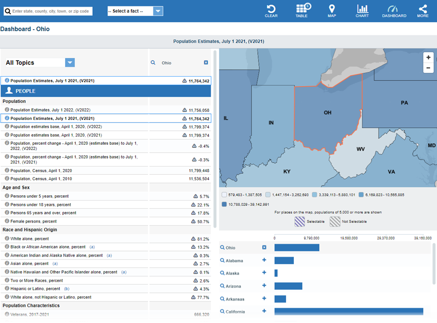
Note: The dashboard above is cropped at the bottom. Click on the image for the full dashboard.
More Stats
From data.census.gov:
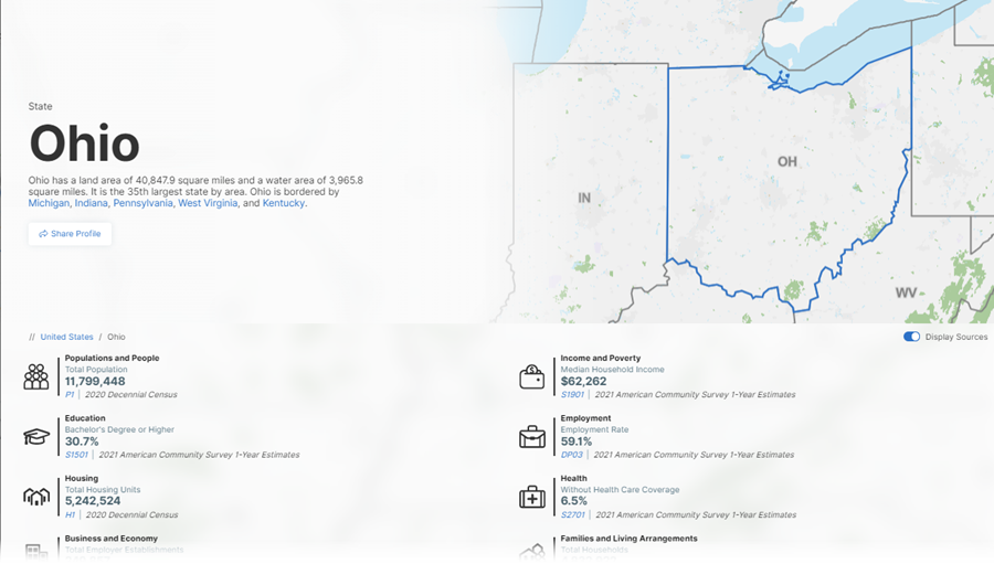
Note: The profile above is cropped at the bottom. Click on the image for the full profile.
Source: 2021 American Community Survey (ACS) 1-year estimates.

Source: 2018 - 2021 Annual Survey of Manufactures (ASM).
Source: 2020 Annual Business Survey (ABS) Program.
Source: 1978-2020 Business Dynamics Statistics (BDS).
Source: 2020 County Business Patterns (CBP).
Source: 2019 Nonemployer Statistics (NES).
Source: Business Formation Statistics (BFS).
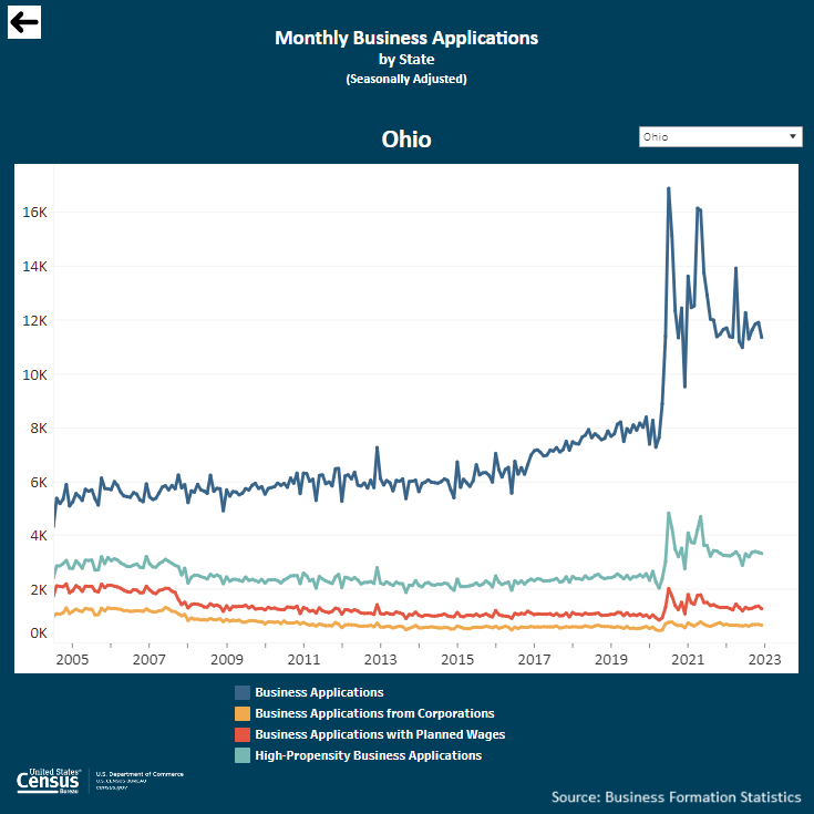
Note: Click on the image above to go to the Business Formation Statistics data page. For the Ohio graphic, scroll down to “Interactive Graphs.” Click on the icon for “Monthly Business Applications by State (BA)” and select “Ohio” in the upper-right drop-down area.
From Business and Economy / International Trade Data:
Note: After you create an account, you can choose between State Export Data (Origin of Movement) or State Import Data (State of Destination) by Harmonized System (HS) or NAICS. More information is available in the Quick Start Guide.
Source: Monthly State Retail Sales.
From the State Data Center (SDC) Program:
From the Library / America Counts: Stories Behind the Numbers:
From the Statistics in Schools (SIS) program:
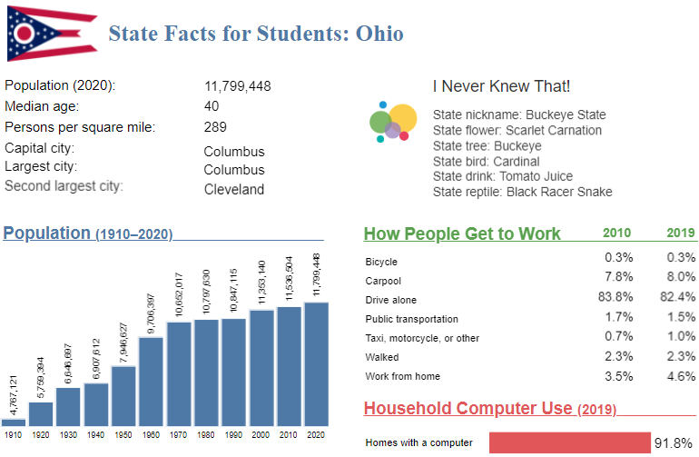
Note: The Ohio page is cropped at the bottom. Click on the image above to go to the “State Facts for Students” main page. Use the drop down to select “Ohio” or click “OH” on the map for the full page for Ohio.
Source: 2017 Economic Census.
From Census.gov / History:
Outside Links
Page Last Revised - February 24, 2023
✕
Is this page helpful?
 Yes
Yes
 No
No
 Yes
Yes
 No
No✕
NO THANKS
255 characters maximum
 255 characters maximum reached
✕
Thank you for your feedback.
Comments or suggestions?

Comments or suggestions?