
Official websites use .gov
A .gov website belongs to an official government organization in the United States.
Secure .gov websites use HTTPS
A lock (
) or https:// means you’ve safely connected to the .gov website. Share sensitive information only on official, secure websites.

Topics
Data & Maps
Surveys & Programs
Resource Library

Stats for Stories: Florida 175th Anniversary (27th state): March 3, 2020
Press Release Number CB20-SFS.42

From the Guide to 2010 State and Local Census Geography — Florida — History:
The United States acquired the area of Florida from Spain in 1819, although the area was not formally transferred until 1821. Florida Territory was organized on March 30, 1822, with generally the same boundary as the present state. Florida was admitted to the Union on March 3, 1845, as the 27th state.
Census data for Florida are available beginning with the 1830 census.
Data for the legally established state of Florida are available beginning with the 1850 census.
Key Stats
From QuickFacts: statistics for all states and counties, and for cities and towns with a population of 5,000 or more.

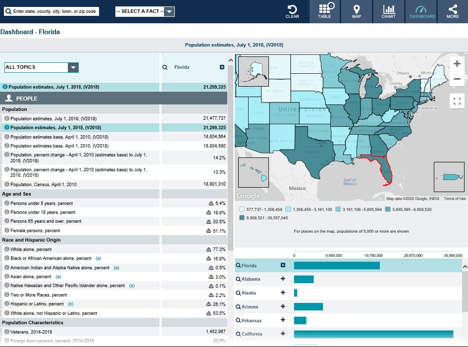
Note: The dashboard shown above is cropped at the bottom. Click on the image to see the full dashboard. Click here to see the table view showing the United States; Florida; Jacksonville city, Florida; Miami city, Florida; Tampa city, Florida; Tallahassee city, Florida (state capital).
More Stats
From data.census.gov — the U.S. Census Bureau's new dissemination platform, replacing American FactFinder (AFF), which will be taken offline on March 31, 2020.
Source: 2018 American Community Survey (ACS), 1-Year Estimates.

From the Statistics in Schools program:
From the State Data Center (SDC) Program:
From Foreign Trade > U.S. International Trade Data:
Note: After you create an account, select options for State Export Data (Origin of Movement) or State Import Data (State of Destination) by HS or NAICS. Select State (Florida) and Measures, Commodity, Country and/or Time for data. For more information, see Quick Start Guide.
Page Last Revised - December 16, 2021
✕
Is this page helpful?
 Yes
Yes
 No
No
 Yes
Yes
 No
No✕
NO THANKS
255 characters maximum
 255 characters maximum reached
✕
Thank you for your feedback.
Comments or suggestions?

Comments or suggestions?