Roaming Around the Census Bureau's Response Outreach Area Mapper
Roaming Around the Census Bureau's Response Outreach Area Mapper
Imagine your job is to ensure a complete and accurate population count of your state, county or neighborhood during the 2020 Census. Perhaps you are a local official, community leader or a census partnership specialist. The stakes are high — billions of federal dollars and representation in Congress depend on census population counts. But, where and how to begin? A variety of factors, including lower trust in government, busier lifestyles and a highly mobile population, have combined to make counting the U.S. population a greater challenge than ever before.
For this very reason, the U.S. Census Bureau is excited to introduce a new tool to make this job easier. The Response Outreach Area Mapper, or ROAM, combines a metric for locating hard-to-count areas — the Low Response Score, or LRS, — with an interactive mapping platform allowing users to identify hard-to-count areas, and to better understand these populations for purposes of 2020 Census outreach and promotion. Identifying areas that need extra attention can help make the most of time and limited resources when devising a communication and outreach strategy.
ROAM displays a map of U.S. census tracts shaded by their LRS. Users can explore the map by zooming and panning around, or by searching for a geography of interest. Perhaps it is an address, place, county, state, congressional district or ZIP Code Tabulation Area — ROAM can zoom you into all of these areas.
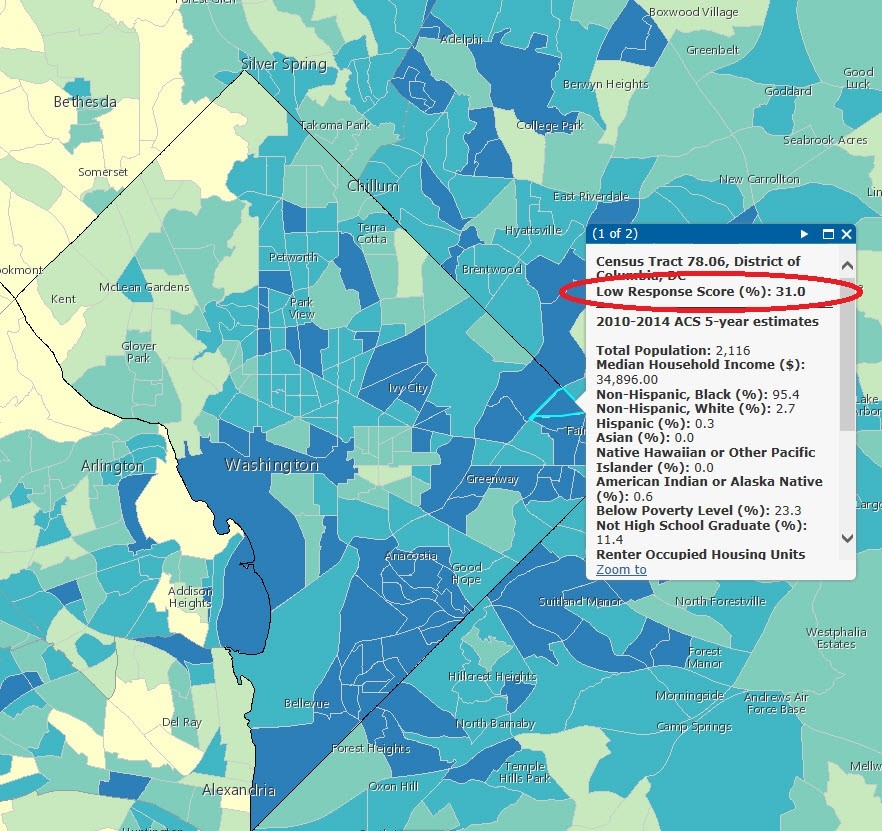
In addition to quickly identifying hard-to-count areas, ROAM also informs users of why a particular area may be hard to count. Click on a census tract to display the LRS and neighborhood characteristics from the Census Bureau’s American Community Survey five-year population estimates. These help paint a picture of a neighborhood — for example, are there languages spoken other than English? How many are renters? How many households include young children? ROAM even has a feature allowing users to select census tracts that meet a set of particular interests. For example, if you want to see census tracts within a particular county that have a high LRS and contain a large percentage of non-English speakers, then use ROAM’s filter option for a quick and easy search. ROAM is now available for public use at <www.census.gov/roam>. Give it a try!
Response Outreach Area Mapper display showing the LRS and select 2010-2014 American Community Survey five-year estimates for a selected census tract in Northeast Washington, D.C.