Happy 25th Anniversary, TIGER
Happy 25th Anniversary, TIGER
When you think of the U.S. Census Bureau, you probably think of surveys and statistics. But did you know that geography is also a big part of our work? Geography plays an important role in creating surveys and collecting data, and it provides meaning and context for our statistics. The Census Bureau conducts research on geographic and address topics, makes reference maps to support censuses and surveys, and creates tools to visualize geographic and statistical data.
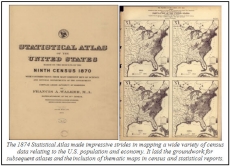
The Census Bureau’s history of mapping population data dates back to the 1860s. Under the direction of Census Superintendent Francis Amasa Walker and Chief Geographer Henry Gannett, the Bureau produced the Statistical Atlas of the United States, a landmark publication that contained innovative data visualization and mapping techniques.

A century later, the Census Bureau was a leader in the early development of computer mapping. In the 1970s, James Corbett of the Statistical Research Division devised a system of map topology that assured correct geographic relationships. His system provided a mathematical base for most future Geographic Information Systems (GIS) work and helped spark the development of computer cartography.
However, at that time, the Census Bureau still relied heavily on paper maps. Census Bureau geographers and cartographers used some computer-scanned mapping files, covering about 280 metropolitan areas, to create paper maps for enumerators to use. For the rest of the nation, paper maps came from a variety of sources, varied in quality and scale, and were quickly outdated.

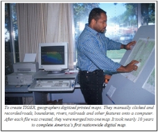
Finally, in preparation for the 1990 Census, the Census Bureau, in collaboration with the U.S. Geological Survey, developed the first nationwide digital map of the U.S., Puerto Rico and other territories called the Topologically Integrated Geographic Encoding and Referencing (TIGER) database. As a national digital map, TIGER contains all of the geographic features — such as roads, railroads, rivers, and legal and statistical geographic boundaries — that are necessary to support the Census Bureau’s data collection and dissemination programs. I was a Census Bureau employee when TIGER debuted, and I still remember the excitement surrounding it. It was hugely innovative and represented an exciting step forward in the way we collect data.

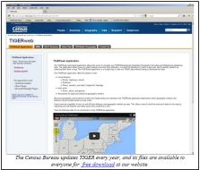
Over the past 25 years, TIGER has evolved into a dynamic mapping system that helped catapult the growth of the GIS industry and improve Census Bureau data products. Today, TIGER is updated annually and available for free download. It provides the nation with a valuable set of geographic information that anyone can use — including businesses, government, nongovernmental organizations and the public. Every state and local government has the capability to create its own GIS with our small-area census data.
The Census Bureau’s history is one of innovation. From the Hollerith tabulating machine to the use of UNIVAC I and the development of TIGER, we have made significant technological advancements — and we will keep on doing so. As the 2020 Census approaches, we are continuing to improve TIGER each year in order to deliver the most timely and reliable statistics.
Happy anniversary, TIGER!


