
Official websites use .gov
A .gov website belongs to an official government organization in the United States.
Secure .gov websites use HTTPS
A lock (
) or https:// means you’ve safely connected to the .gov website. Share sensitive information only on official, secure websites.

Topics
Data & Maps
Surveys & Programs
Resource Library
Providing Information for Emergency Preparedness as Arthur Approaches
Providing Information for Emergency Preparedness as Arthur Approaches
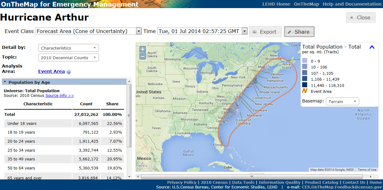
As many Americans begin to prepare for Hurricane Arthur this week, the Census Bureau’s OnTheMap for Emergency Management tool helps provide federal, state and local officials and emergency planners with the information they may need about communities in the projected path of the storm.
OnTheMap for Emergency Management is a Web-based resource that provides a live view of selected emergencies in the U.S., 24 hours a day, 7 days a week. It automatically incorporates real-time updates from federal sources so users can view the potential effects of Tropical Storm Arthur (and other disasters) on the U.S. population and workforce.
Through OnTheMap for Emergency Management, the Census Bureau provides information not just on the number of people affected, but also provides useful information on some of their characteristics (for example, whether they are 65 or older) and their work (such as their employment patterns). Following Super Storm Sandy, New Jersey planners were able to estimate the volume of traffic in affected areas.
As the storm continues to develop, the Census Bureau will work closely with our federal partners to make sure they have the information they need.
For those of you preparing for the storm, you can find hurricane safety tips at www.ready.gov/hurricanes. Visit the National Hurricane Center for the latest Arthur forecasts and remember to follow the National Weather Service for active alerts.
Page Last Revised - March 22, 2022
✕
Is this page helpful?
 Yes
Yes
 No
No
 Yes
Yes
 No
No✕
NO THANKS
255 characters maximum
 255 characters maximum reached
✕
Thank you for your feedback.
Comments or suggestions?

Comments or suggestions?