What the Census Bureau Can Tell You About Some of the Communities Affected by Hurricane Sandy
What the Census Bureau Can Tell You About Some of the Communities Affected by Hurricane Sandy
My heart goes out to all of the people in communities affected by Hurricane Sandy. One way that the Census Bureau can help people impacted is to provide vital information about their communities.
This information is important to the first responders and others who will help those affected get back on their feet again, rebuild and prepare for potential future emergencies. You may be familiar with our local statistics and may have even used them to learn about your community, but did you know they are also critical to emergency planning, preparedness and recovery efforts?
The Census Bureau provides information not just on the number of people affected, but also information about who they are, for example are they elderly, what are their occupations and how they get to work each day. The Census Bureau also provides information about the homes affected, such as is it an area where people heat their homes with propane tanks or are there many mobile homes in the area?
We also have information about the businesses in the area, because a disaster affects not just people who live in an area, but also the people who work there. This information is all available on census.gov.
Our official population estimates, along with annually updated socioeconomic data from the American Community Survey, as well as our economic statistics, provide a detailed look at our coastal populations, such as communities in New York and New Jersey and throughout the East Coast, who bore the brunt of Hurricane Sandy.
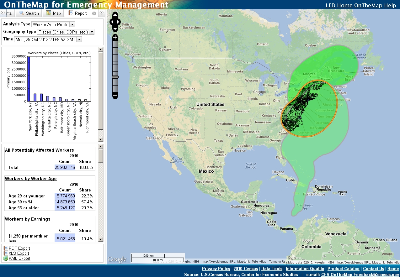
A new Census Bureau tool, OnTheMap for Emergency Management helps communities prepare for an emergency. This tool traced the path of Hurricane Sandy starting on October 22. As the predictions about the Storm’s path changed, data on potential impacts were automatically updated. This innovative tool provides information about the potentially affected population, the kinds of businesses impacted by a natural disaster, and the number and characteristics of workers, as well as where they live. You can use it to look at statistics for declared disaster areas and learn about things like the impacted industries, the ages of workers and workers’ earnings. These statistics can be used by communities to know not only how many people live in an area where there is a disaster but also how many people work in those areas.
When a storm hits, one of the first questions many people have is the size of the population affected. For example, almost 4.4 million people lived in counties declared as disaster areas in New Jersey, more than 11 million in New York and more than 2 million in Connecticut in 2011.
Digging deeper, when communities prepare for or respond to disasters, they often look at what vulnerable populations will need additional assistance. For example, they may look at the size of the elderly population. According to 2011 population estimates, in the counties with a major disaster declaration in New Jersey and New York, 13.8 percent and 12.9 percent of the population are 65 or older respectively. In Connecticut, 14.3 percent of the population in counties declared as disaster areas are 65 or older.
In addition to statistics from our population estimates, the American Community Survey can provide even more detailed information, such as how many people in a community speak a language other than English at home or are disabled. Knowing about these statistics give communities the information they need to plan how to provide services for these populations.
Another question often asked following an event like Hurricane Sandy is the economic impact. Census Bureau economic statistics can help communities measure this by having benchmark information about the number and location of business establishments and jobs from before the storm.
For example, if we look at our 2010 County Business Patterns data, we learn that there were 479,075 business establishments in the Connecticut, New Jersey and New York counties declared major disaster areas. The total employment and annual payroll in these areas was 6,723,791 and $427.4 billion respectively. These counties represent 61.2 percent of the total employment in Connecticut, 45.7 percent of the total employment in New Jersey, and 59.2 percent of the total employment in New York state. The Local Employment Dynamics Program is another resource that can provide information on businesses and workers at small areas and by detailed characteristics.
These are just a few of the statistics available about these areas and how communities use them. You can explore more statistics about these areas by visiting our Census Data and Emergency Preparedness page.