An official website of the United States government
Here’s how you know
Official websites use .gov
A .gov website belongs to an official government organization in the United States.
Secure .gov websites use HTTPS
A lock (
) or https:// means you’ve safely connected to the .gov website. Share sensitive information only on official, secure websites.
-
//
- Census.gov /
- Newsroom /
- 2014 Press Releases /
- Census Bureau Emergency Management Mapping Tool Adds Improvements
For Immediate Release: Tuesday, June 24, 2014
Census Bureau Emergency Management Mapping Tool Adds Improvements
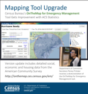
Today, the U.S. Census Bureau released updates to the OnTheMap for Emergency Management tool. The public data tool provides an intuitive Web-based interface for viewing the potential effects of disasters on the U.S. workforce and population. Users can easily retrieve reports containing detailed workforce, population and housing characteristics for hurricanes, floods, wildfires, winter storms and federal disaster declaration areas.
Updates:
- Addition of detailed social, economic and housing statistics from the American Community Survey.
- Addition of customizable reports that can be generated for specific communities for regional, local and comparative analyses.
- Improved event search tool and dashboard interface.
- New linkable maps and reports for easier sharing.
- New charts.
No news release associated with this report. Tip Sheet only.
-X-
Share
Contact
Related Information
Some content on this site is available in several different electronic formats. Some of the files may require a plug-in or additional software to view.
 Yes
Yes
 No
NoComments or suggestions?


Top


