
Official websites use .gov
A .gov website belongs to an official government organization in the United States.
Secure .gov websites use HTTPS
A lock (
) or https:// means you’ve safely connected to the .gov website. Share sensitive information only on official, secure websites.

Topics
Data & Maps
Surveys & Programs
Resource Library
Demobase Saint Vincent and the Grenadines
Demobase Saint Vincent and the Grenadines

Demobase Saint Vincent and the Grenadines
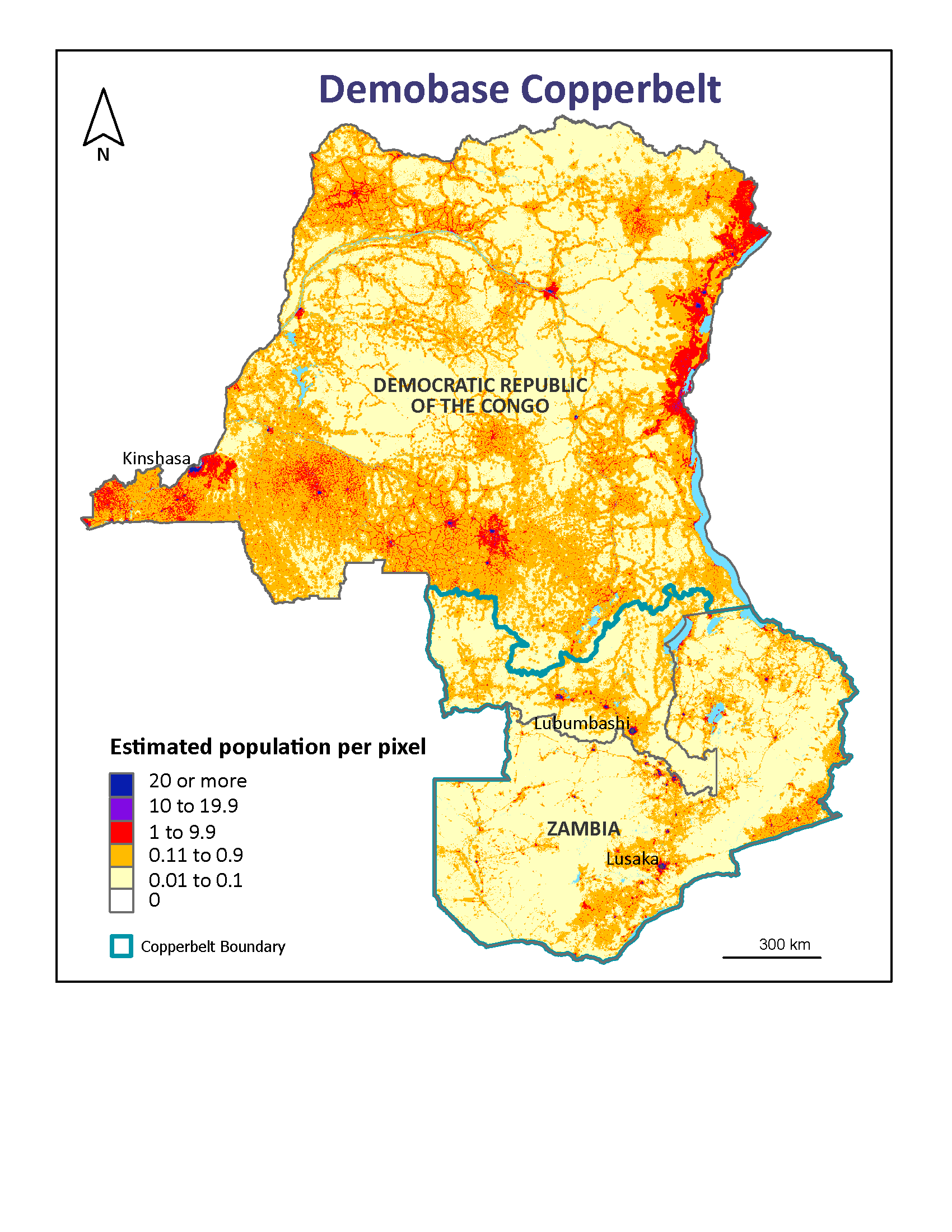
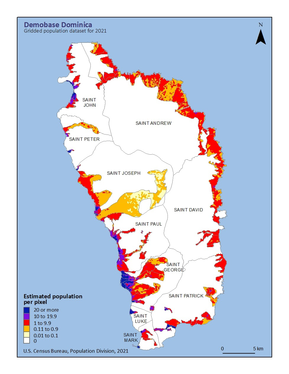
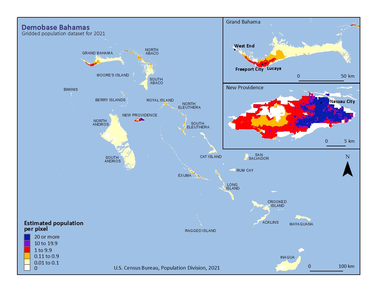
Using the method applied to The Bahamas and Dominica, the Census Bureau mapped Saint Vincent and the Grenadines. A variety of spatial datasets were combined with 2012 census data and 2021 population estimates to produce gridded population layers.
Data Download

Other Demobase Visualizations

Related Information
Page Last Revised - February 12, 2025
✕
Is this page helpful?
 Yes
Yes
 No
No
 Yes
Yes
 No
No✕
NO THANKS
255 characters maximum
 255 characters maximum reached
✕
Thank you for your feedback.
Comments or suggestions?

Comments or suggestions?