
Official websites use .gov
A .gov website belongs to an official government organization in the United States.
Secure .gov websites use HTTPS
A lock (
) or https:// means you’ve safely connected to the .gov website. Share sensitive information only on official, secure websites.

Topics
Data & Maps
Surveys & Programs
Resource Library
Demobase Pakistan
Demobase Pakistan

Demobase Pakistan
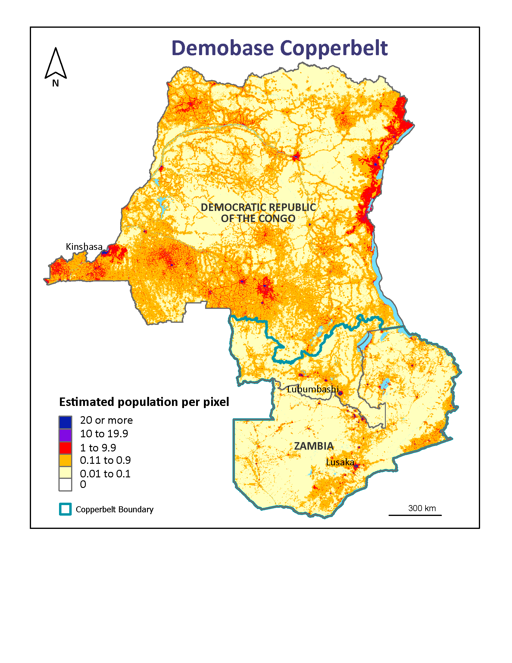
Following the success of the Haiti project, the Census Bureau tackled Pakistan, a much larger country that also is affected by frequent natural disasters. The methods developed for Haiti were refined for Pakistan, where a similar correlation was found between built-up areas and 1998 census data. The 100-meter gridded population map was made available to the public during summer 2010’s severe flooding via a viewer and a data download page. The methods used in the Pakistan project are described in a paper ![]() published in the journal Remote Sensing of Environment.
published in the journal Remote Sensing of Environment.

Related Information
Page Last Revised - October 5, 2023
✕
Is this page helpful?
 Yes
Yes
 No
No
 Yes
Yes
 No
No✕
NO THANKS
255 characters maximum
 255 characters maximum reached
✕
Thank you for your feedback.
Comments or suggestions?

Comments or suggestions?