
Official websites use .gov
A .gov website belongs to an official government organization in the United States.
Secure .gov websites use HTTPS
A lock (
) or https:// means you’ve safely connected to the .gov website. Share sensitive information only on official, secure websites.

Topics
Data & Maps
Surveys & Programs
Resource Library
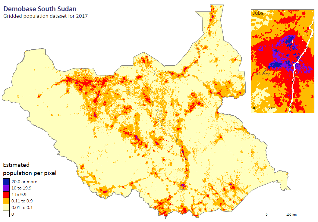
Demobase Haiti
Demobase Haiti

Demobase Haiti
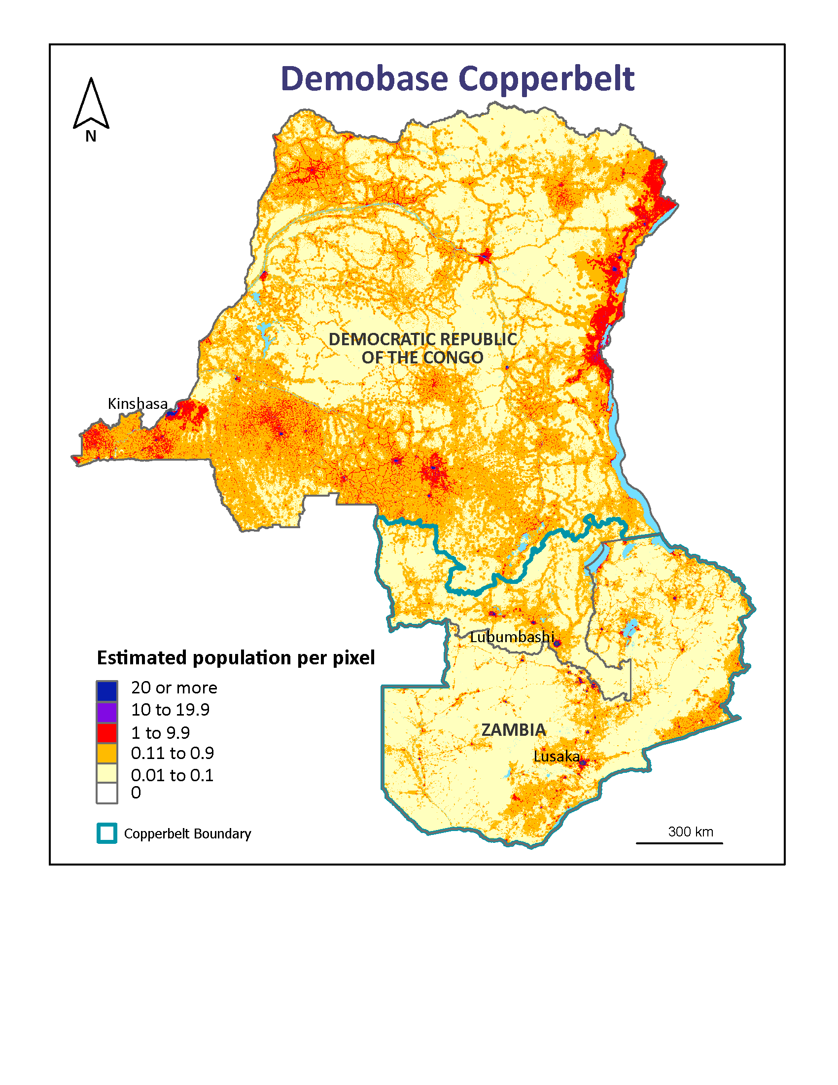
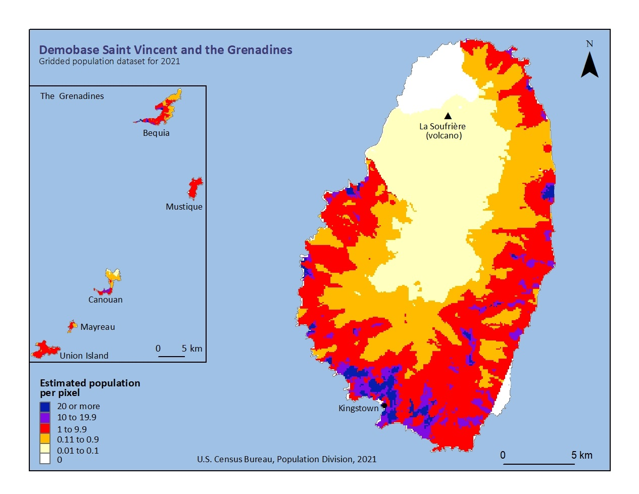
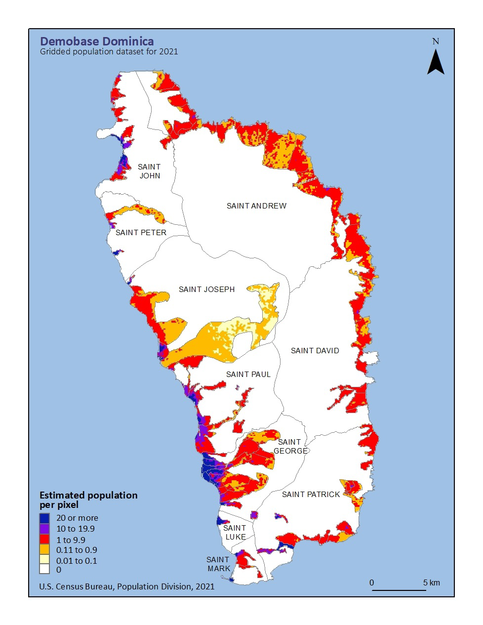
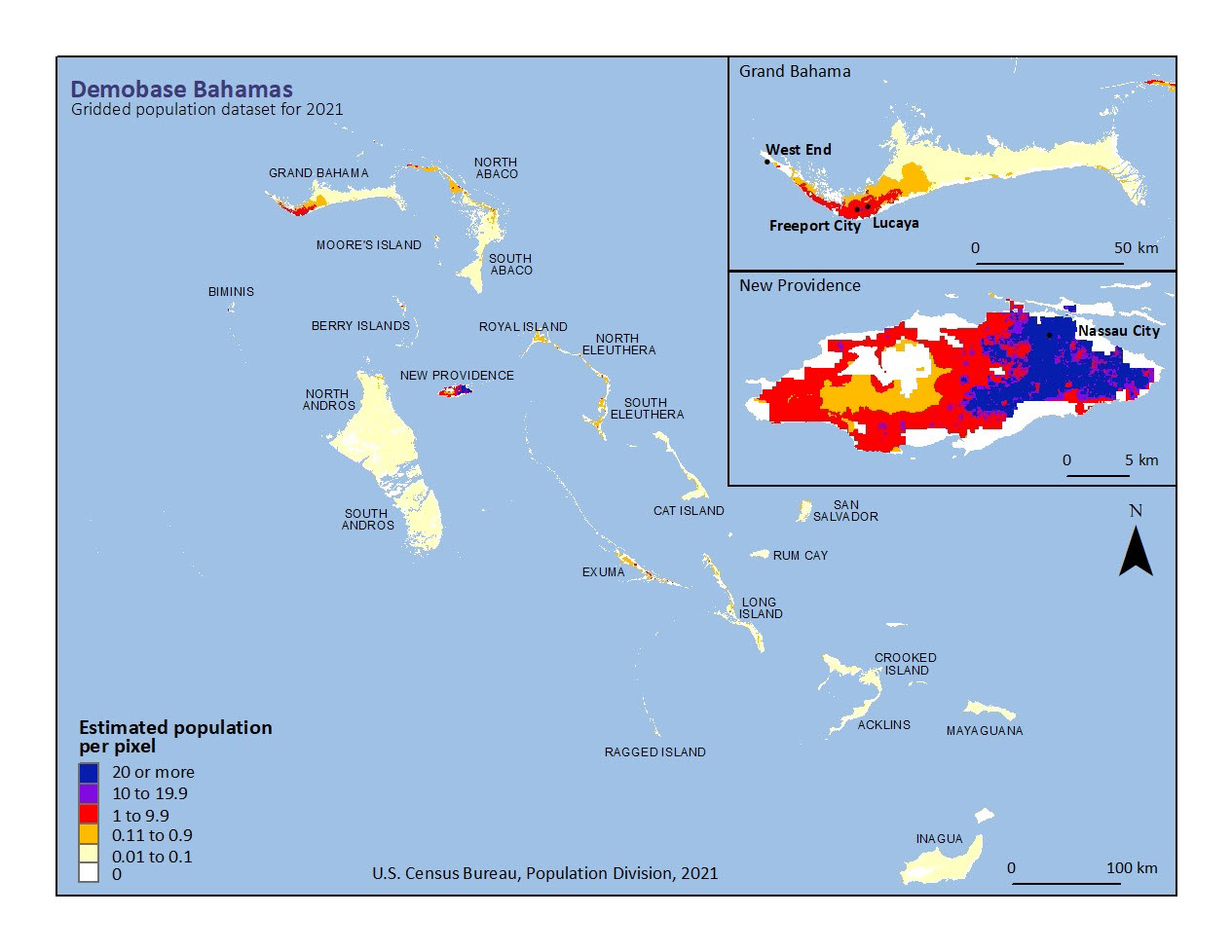
Haiti was chosen as the pilot country for developing our population mapping methods, based on its high frequency of hurricanes and other natural disasters in the recent past. We found a clear correlation between built-up area density derived from interpretation of high- and medium-resolution satellite imagery and data from the 2003 national census. The resulting 100-meter gridded population map is the finest-scale demographic map of the country ever produced. It was made available to the public the day after the devastating earthquake of January 2010, and has been used extensively for disaster relief. The methods used in the Haiti project are described in a paper ![]() published in the International Journal of Remote Sensing.
published in the International Journal of Remote Sensing.

Related Information
Page Last Revised - October 5, 2023
✕
Is this page helpful?
 Yes
Yes
 No
No
 Yes
Yes
 No
No✕
NO THANKS
255 characters maximum
 255 characters maximum reached
✕
Thank you for your feedback.
Comments or suggestions?

Comments or suggestions?