
Official websites use .gov
A .gov website belongs to an official government organization in the United States.
Secure .gov websites use HTTPS
A lock (
) or https:// means you’ve safely connected to the .gov website. Share sensitive information only on official, secure websites.

Topics
Data & Maps
Surveys & Programs
Resource Library
OnTheMap for Emergency Management Infographic
OnTheMap for Emergency Management Infographic
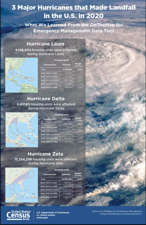

This infographic highlights the three major hurricanes that made landfall in the U.S. in 2020 and the total housing units and the year the structure was built in the impacted areas.
Sources and Reference
OnTheMap for Emergency Management is a public data tool that provides an intuitive web-based interface for accessing U.S. population and workforce statistics, in real time, for areas being affected by natural disasters. The tool allows users to retrieve reports containing detailed workforce, population, and housing characteristics for hurricanes, floods, wildfires, winter storms, and federal disaster declaration areas.
Page Last Revised - October 8, 2021
✕
Is this page helpful?
 Yes
Yes
 No
No
 Yes
Yes
 No
No✕
NO THANKS
255 characters maximum
 255 characters maximum reached
✕
Thank you for your feedback.
Comments or suggestions?

Comments or suggestions?