
Official websites use .gov
A .gov website belongs to an official government organization in the United States.
Secure .gov websites use HTTPS
A lock (
) or https:// means you’ve safely connected to the .gov website. Share sensitive information only on official, secure websites.

Topics
Data & Maps
Surveys & Programs
Resource Library
U.S. Census Bureau Provides Economic Data to National Weather Service’s 122 Weather Forecasting Offices
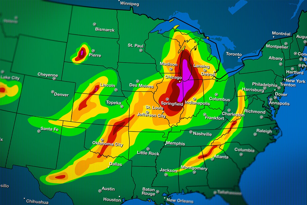
Weather has always had a powerful impact on the well-being of people. It also has an impact on the people who own and run businesses in affected areas.
The mission of the National Weather Service (NWS) is to provide weather, water and climate data, forecasts and warnings for the protection of life and property and enhancement of the national economy. Today, the NWS is working toward a strategic vision of a “Weather-Ready Nation,” one where society is prepared to respond to weather, water and climate events.
This tool could help local forecast offices provide information to the emergency management community and other public safety decision makers.
First created in 1870 as part of the U.S. Army and now part of the Department of Commerce’s National Oceanic and Atmospheric Administration, the NWS not only collects and analyzes environmental data from across the globe but also uses socio-economic data to deliver improved products and services.
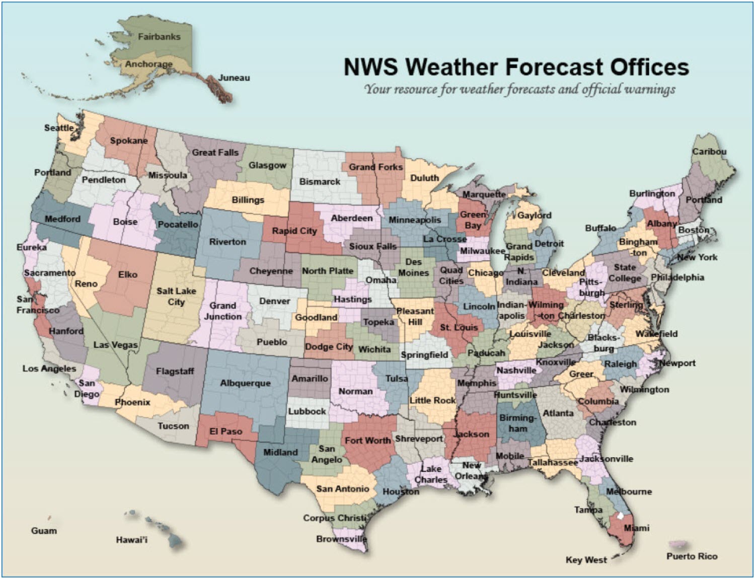
NWS has 122 Weather Forecasting Offices (WFOs) that provide forecasts and severe weather warnings for their region of the country. Each WFO covers one or more counties. The Key West WFO, for example, covers only one county while the Peachtree City (Atlanta) WFO covers 96.
In January, the Census Bureau officially launched a special website for these WFOs at the American Meteorological Society Annual Conference in Boston. This site provides links to a map and report for each WFO to Census Business Builder: Regional Analyst Edition (CBB: RAE). It also includes links to the main NWS page where users can learn more about each weather forecasting office.
CBB: RAE allows users to build custom regions made up of groupings of states, counties, cities/towns, ZIP Codes and even census tracts. This tool could help local forecast offices provide information to the emergency management community and other public safety decision makers.
The tool presents over 170 demographic and economic data variables, which can be viewed on an interactive map or in a report. Data are available not only for the entire region but also for each region component. Users can then drill down within an area to view even more detailed data, which will help officials make public safety decisions.
For years, the Census Bureau has been actively involved with the Federal Emergency Management Agency (FEMA) and other organizations to provide data for disaster preparedness, response and recovery. We have also trained FEMA and emergency management staff to use our tools to access these data and aid in their operations.
The creation of CBB: RAE was a natural extension of that longstanding partnership.
Census also has another data tool that weather experts can use. OnTheMap for Emergency Management (OTMEM) provides population and workforce data using feeds from other federal agencies for disaster declaration areas for hurricanes, floods, wildfires, winter storms.
These two data tools and the new WFO site help weather forecasters, broadcasters, the public and others access key data they need to understand how weather events may affect their communities.
Users can access data for ongoing and historical events in OTMEM and potential events in CBB: RAE. They can also provide feedback on the sites and even advise the Census Bureau to add new data they need to understand the full impact of weather on a community and region.
Chip Walker and Andrew W. Hait are co-leads of the Census Bureau’s Emergency Preparedness and Response Team.
America Counts Story
Key Player in Disaster Response: The U.S. Census Bureau
Community planners rely on census statistics to prepare evacuation plans and supply distribution after natural disasters and...
America Counts Story
Fighting Fires With Data
New Orleans Fire Department uses Census Bureau data to identify homes without smoke detectors- and gives out free ones where most needed.
America Counts Story
94.7M Americans Live in Coastline Regions
Coastline counties most vulnerable to hurricanes continue to grow. In the midst of the Atlantic hurricane season. See how many people live along the coasts.
Page Last Revised - October 8, 2021
✕
Is this page helpful?
 Yes
Yes
 No
No
 Yes
Yes
 No
No✕
NO THANKS
255 characters maximum
 255 characters maximum reached
✕
Thank you for your feedback.
Comments or suggestions?

Comments or suggestions?