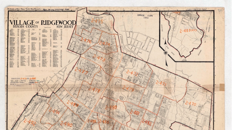
"1950 Enumeration District Map for Bergen and Ridgewood, NJ"

The Census Bureau began using enumeration district maps in 1880. Meticulously drawn by census cartographers, these maps covered an area that an enumerator was expected to cover during the census period. The maps—like this 1950 map for Ridgewood in Bergen County, NJ—included streets, boundaries, and water features to aid the enumerator in their rounds. Many other features could be included on maps to help an enumerator find addresses, such as railroads, fences, prominent buildings or landmarks, and natural features.
Today, we use census tracts instead of enumeration districts and enlist the help of local governments and interested parties to make sure our tracts are as accurate as possible prior to each census through the Participant Statistical Areas Program (PSAP). Learn more about the history of cartography and geography at the History Web site's Geography Web pages.


