
Official websites use .gov
A .gov website belongs to an official government organization in the United States.
Secure .gov websites use HTTPS
A lock (
) or https:// means you’ve safely connected to the .gov website. Share sensitive information only on official, secure websites.

Topics
Data & Maps
Surveys & Programs
Resource Library
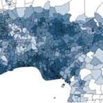
Subnational Population Data by Geographic Area
Subnational Population Data by Geographic Area
The Census Bureau calculates subnational 5-year age/sex group population estimates and projections for various years from 2000 through 2030 for countries sharing bilateral efforts with the U.S. Government as part of the United States President’s Emergency Plan for AIDS Relief (PEPFAR). The PEPFAR program provides assistance to countries around the world whose populations suffer from a high rate of HIV infection. Our subnational population data are consistent with the national projections from the U.S. Census Bureau's International Data Base and are linked to digital maps of the subnational administrative areas. These products also are available through the DHS Program Spatial Data Repository.
The Census Bureau also calculates subnational 5-year age/sex group population estimates and projections for the years 2000 through 2040 for the U.S. Agency for International Development, Bureau for Global Health, Office of Population and Reproductive Health (PRH).
The Census Bureau collects, evaluates, and geo-enables subnational demographic and socioeconomic data for the United States Agency for International Development (USAID) Bureau for Humanitarian Assistance (BHA). BHA provides life-saving humanitarian assistance – including food, water, shelter, emergency healthcare, sanitation and hygiene, and critical nutrition services – to the world’s most vulnerable and hardest-to-reach people. Our data are geographically enabled to facilitate the provision of effective and timely assistance to areas under stress. These products also are available from the Humanitarian Data Exchange.
A selection of the subnational products available on this page are also available in the Census Bureau’s International Database (IDB).
Documentation


Subnational data for each country are available from the national level through the unit types and administrative (ADM) levels listed below. Typically, geospatial boundaries are available for each country at the same ADM levels.
Available products:
- PEPFAR E&Ps - PEPFAR Estimates and Projections
- PRH E&Ps - PRH Estimates and Projections
- BHA E&Ps - BHA Estimates and Projections
- BHA PHTs - BHA Population and Housing Tables


Related Information

Page Last Revised - December 12, 2024
✕
Is this page helpful?
 Yes
Yes
 No
No
 Yes
Yes
 No
No✕
NO THANKS
255 characters maximum
 255 characters maximum reached
✕
Thank you for your feedback.
Comments or suggestions?

Comments or suggestions?